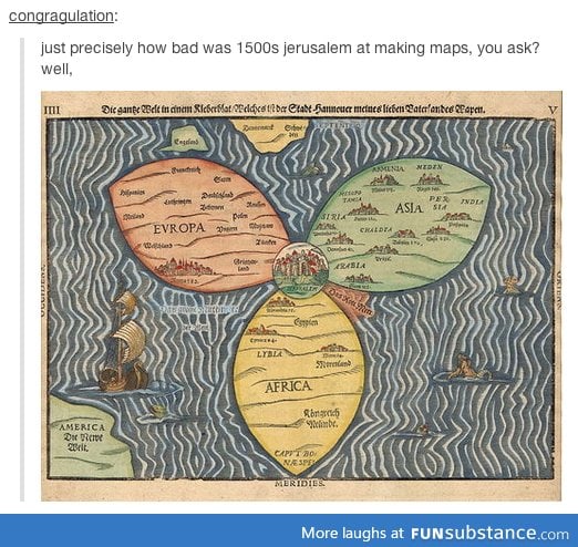
Medieval maps weren't drawn to be geographically accurate but to give the viewer an idea of what things were out there - a sort of pictorial encyclopedia. If you wanted to go some place you'd have a list, much like the list you get from Google Maps when you plot a journey from A to B. So you'd start and head to the first place on the list and then ask directions to the next place on the list. This is why they had cities which became hubs on pilgrim trails - they were on the established travel routes. The reason Jerusalem is in the middle is because that was considered the center of the world to the main European religions. So much so that maps were turned East towards the Holy Land with Jerusalem at the top (not on this one though), rather than North like we do now. This is where we get the concept of "oriented" with respect to maps, because they were centered East towards the Orient.
Comments